The story of Aotearoa, like that of all countries, is a story shaped by the land use decisions made by communities. Big decisions and small decisions - all impacting our natural world and contributing to our current environmental challenges.
We’re at a point where we have much greater awareness of how our decisions shape the natural world. Here in Aotearoa we can see the impacts first hand. The degradation of our freshwater, the biodiversity crisis, and the natural disasters becoming more prevalent as a result of climate change.
And while it can feel a bit doom and gloom, we do have means for improving how we make decisions - big and small - from here on out. We also have some great programmes guiding people through the decision making process, and scaling the changes needed to address the greatest challenges of our time. In particular the Kaipara Moana Remediation (KMR) programme.
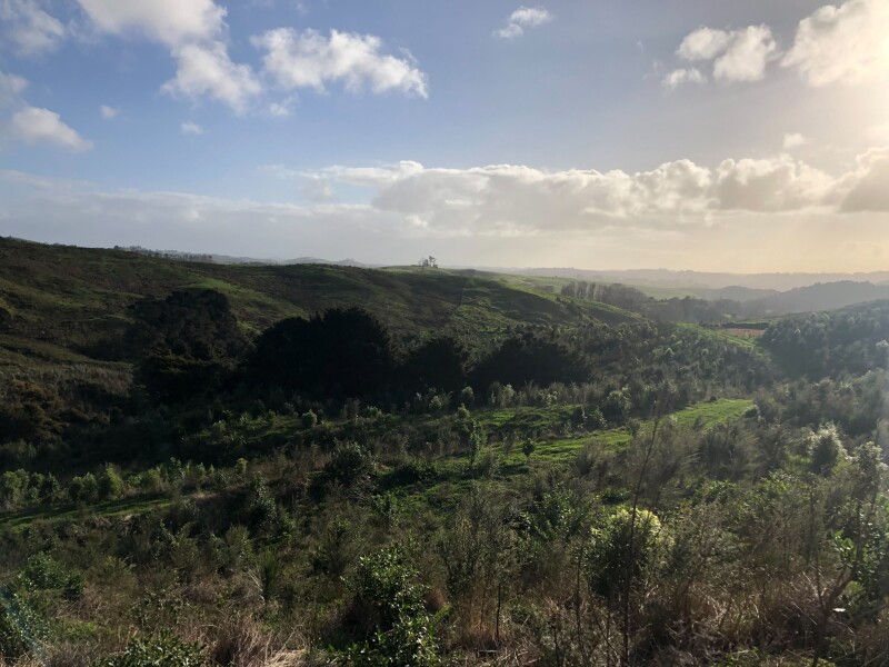
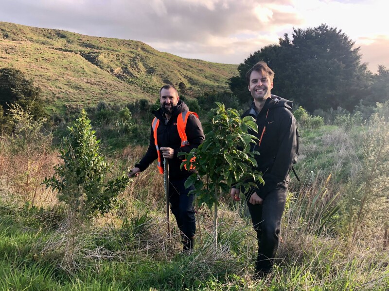
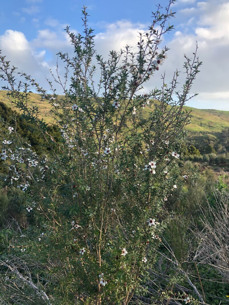
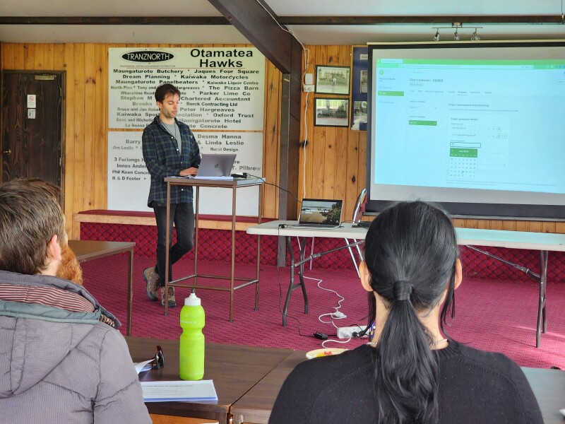
I was recently in Northland to see the KMR programme really hit its stride. I got to assist in a training session with KMR Field Advisors who are getting into the flow of programme delivery. I was also lucky enough to assist in reviewing recent planting work, on a property that’s been planting for three consecutive years. Seeing already established mānuka in flower, it is hard not to feel positive about the opportunities in front of us.
MadeCurious has been working with the KMR programme on digital tools that are helping to scale the speed and impact of the work. My recent trip north helped to really highlight three key ways these digital tools are helping achieve this scale.
First, some context.
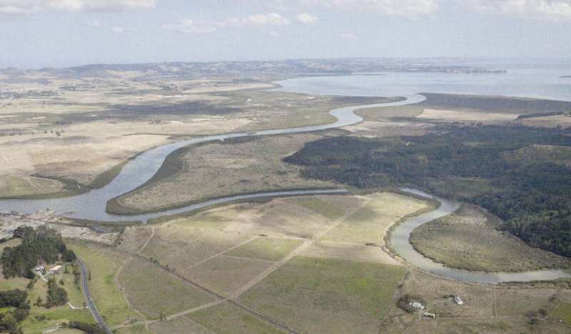
The Kaipara Moana
The Kaipara Moana is Aotearoa’s largest harbour, and the largest natural harbour in the Southern Hemisphere. The catchment land area that feeds it is massive - over 6,000 square kilometres. The harbour and surrounding catchment includes rare freshwater, sand-dune, seagrass and estuarine ecosystems.
Changes to land use have contributed to a vast increase in the amount of sediment that flows through the system and into the Kaipara Moana - estimated to be seven times higher now than before human settlement. The sediment chokes out the delicate ecosystems, significantly impacting fish and shellfish populations that sustain customary, recreational, and commercial fisheries.
The decisions that led to the changes in land use across the Kaipara Moana catchment are numerous; some large, some small, some encouraged by government policies, some made by self-interest. The result of all these decisions has been large scale deforestation and land use intensification. There is now less than 10 percent of original native forest remaining, and only five percent of wetlands.
Responding to the Challenges
The Kaipara Moana Remediation programme was established in 2020. It is intended to last a decade, and requires a $200 million investment - which includes $100 million from the Crown, contributions of $10 million each from Auckland Council and Northland Regional Council, and the remainder sourced from landowners, industry associations and philanthropic organisations.
And while this level of financial investment is crucial, the scale of the ambitions requires the buy-in of local communities and businesses in order to be successful. This is why the KMR programme has brought together new operating models of co-governance, collaboration, impact modelling, and community and hapu-led work - all working together to improve the mauri of the Kaipara Moana. It is this holistic approach, with people at the centre of the system, that provides a model for scaling future success across Aotearoa.
There are so many positive ways in which the KMR programme is scaling the impact it has, many of which can be applied both nationally and internationally. However, I want to focus on three areas that relate to MadeCurious’ work with the programme.
Scaling Impact 1: Seamless Action Accounting
Action accounting determines whether a given action or project actually contributes to the environmental remediation goal. In this case, given the amount being invested, we want to be sure that any funded work is actually reducing sediment loss into the Kaipara Moana.
This action accounting occurs across the lifecycle of a grant - first engaging with properties that are suitable candidates, then planning and costing the work, getting expert review of these plans, ensuring the work is done to standard, and finally making sure the right grant amounts are paid.
Action accounting can therefore be quite challenging - requiring lots of data and context, as well as different people inputting at different stages.
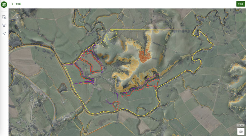
MadeCurious worked with the KMR Programme to develop the Mātai Onekura digital tool: a one stop shop for managing the end-to-end process.
Mātai Onekura is spatially-based; with each property involved in the programme having its own unique sediment reduction plan. Each sediment reduction plan outlines the key risks and aspirations of the property, including the awa, slope, land use and regulatory considerations. This informs prioritised projects that can be staged over multiple years. Those projects consist of spatially mapped actions to reduce sediment loss. These include:
- Fencing, gates, and troughs to exclude stock from waterways and protect vegetative areas
- Riparian and wetland area plantings
- Hill country planting to stabilise slope areas in native plants, or poplars where appropriate
- Assisted regeneration of existing native vegetation areas
The estimated costs and agreed KMR contribution to these actions are all auto-calculated, for example, the predicted cost of planting for the farmer and the programme. This not only reduces a heap of manual work, but it allows the KMR programme to account for grant funding down to individual fences or planting areas. All site photos, conversations and review decisions are logged and timestamped, providing a full digital audit history to provide additional reassurance of the action accounting.
Action accounting has simply become a function of business-as-usual for KMR staff, allowing them to focus on delivering real change with landowners and community groups rather than project admin.
Freeing up teams to focus on the change is one of the largest benefits of digital tools when it comes to scaling environmental remediation. And given the KMR programme is on track to hit the 2 million tree mark this season, that scale is certainly being achieved!
Scaling Impact 2: Guided Decision Making
If we are to influence the small, local decisions that ultimately change land use to improve the mauri of the Kaipara Moana, and other water bodies around Aotearoa, then we need to guide this decision making. This speaks to the very human-focused aspect of the KMR programme.
There are lots of puzzle pieces involved in prioritising actions on land to achieve the desired environmental outcomes - there’s the science, the regulatory context, the commercial overlay, the intention of neighbouring properties, all requiring some calculated crystal ball gazing. The KMR programme has made this far more manageable and enabled those to have effective kōrero with those on the ground.
The Mātai Onekura tool has helped considerably with this. When looking at the spatial view of a property, a user is able to toggle between a selection of curated datasets - from state-of-the-art slope modelling and visualisation, LiDAR-derived sediment loss risk prediction, context of any previously funded work prior to the KMR programme (and more).
Prompts appear within Mātai Onekura to support Field Advisors using this information, as well as any regulatory context for scoping projects. Any project actions that are created in Mātai Onekura also start with best practice defaults for things like plant spacing, with the flexibility to change where appropriate for a specific site.
Centralising the relevant information about a property in one place enables Field Advisors to visit new properties well prepared, allowing them to maximise their time on site and have more informed conversations with landowners that shape the decisions and land use and investment. Ultimately this more rapidly scales the knowledge and best practice recommendation dissemination across the communities in the Kaipara Moana catchment.
Ensuring that all the context contained in Mātai Onekura is understood does require ongoing support to help KMR Field Advisors put it into practice.
Scaling Impact 3: Collaborative Planning and Mentoring
One of the main objectives of the KMR programme is to build kotahitanga by enabling the community to work together. Collective ownership and understanding of the problem, and potential solutions, is key to shaping land use decisions towards better environmental outcomes.
Another objective of the programme is to up-skill local tangata and provide employment opportunities for effective land management. This requires strong support and training to ensure roles like KMR Field Advisors can have effective kōrero with those working on the whenua, and can facilitate collective decision making.
The KMR programme not only provides regular training and resources to support Field Advisors and others, but the digital tools used also facilitate collaborative land management and mentoring.
For example, the programme uses a Tuakana/Teina (big sibling, little sibling) model where senior staff work with junior staff to develop sediment reduction plans and projects across the catchment. The Mātai Onekura tool enables both Tuakana and Teina to work collaboratively on a plan in real-time. And because so much of the context for making good land management decisions is embedded into Mātai Onekura, it becomes a really effective tool for practical teaching.
Plans and projects can also be easily shared with landowners and community groups for their feedback, as well as for contract generation once work is agreed. This supports regular check-ins after any initial site visits.
The KMR programme is also exploring opportunities to share plans and projects more collectively across sub-catchment areas to build greater kotahitanga and a sense of shared community effort.
Scaling Across Aotearoa, and Beyond
The sheer size of the catchment feeding the Kaipara Moana means the programme of work to help restore the mauri of the harbour needs to happen at a scale that has not really been seen in this country. As such, the Kaipara Moana Remediation programme provides a great blueprint for improving environmental outcomes across the whole of Aotearoa, as well as other whenua around the world.
And while improving land management requires financial incentives and investment, it is the investment in people and communities that can facilitate the biggest changes.
I’m really proud to have worked with the KMR programme over the past four years. The digital tool that MadeCurious has worked on in partnership with the programme has been a great example of how technology can reduce the administrative burden and enhance the localised decision-making process. Combined this helps scale the knowledge and the impact of those working to improve the land that is so important to us all.